Skip to content Skip to left sidebar Skip to right sidebar Skip to footer

Notices

Pipe Burst in Blanco and a Water Truck has been Dispatched

PIPE BURST IN BLANCO AND A WATER TRUCK HAS BEEN DISPATCHED
Issue by George Municipality, 3 March 2024 @12:25

A pipe burst occurred in the mains on the Corner of Soeteweide & Montagu Streets in Blanco.
ETR 4HRS. Affected areas are Soeteweide Str; Soeteweide Country Estate; and Farms under the MOD water scheme. A Water truck has been dispatched and will be stationed at the entrance to Soeteweide Country Estate.

Urgent Notice: Water Outage – Fairbourne Road and Rooirivier Rif

Issued by George Municipality, 02 March 2024 @12:05

George Municipality’s Water Maintenance Team is busy with a main water pipe leak on Fairbourne Road in Kingswood and had to isolate this section of the water network in Barkhuisen Drive. As a result of this, a wider area is affected, due to a faulty valve not isolating properly that normally isolates this section of Kingswood.

Due to this Rooirivier Rif will also be affected by water outage.

We apologize for any inconvenience caused and request the public’s patience while we’re attending to the leak. The estimated time of repair is 2 hours.

Eskom Loadshedding Update, 1 March 2024

POWER ALERT 1 Loadshedding to be suspended from 05:00 until 16:00 on Saturday. Friday, 01 March 2024: Due to the anticipated return to service of additional generating units over the weekend, Stage 2 loadshedding will continue to be implemented until 05:00 on Saturday. Thereafter, loadshedding will be suspended until 16:00. Stage 2 loadshedding will resume from 16:00 until 05:00 on Sunday. This alternating pattern of suspending loadshedding from 05:00 until 16:00 and implementing Stage 2 loadshedding from 16:00 until 05:00 will be repeated on Sunday.

George will be affected as follows:

Friday 01/03/2024
22:00 – 00:30

Saturday 02/03/2024
22:00 – 00:30

Sunday 03/03/2024
None

Uniondale will be affected as follows:

Saturday 02/03/2024
01:00 – 03:30

Sunday 03/03/2024
01:00 – 03:30

Planned Electricity Supply Interruption: Portion of Pacaltsdorp

PLANNED ELECTRICITY SUPPLY INTERRUPTION: PORTION OF PACALTSDORP

THE FOLLOWING AREAS WILL BE AFFECTED:
PORTION OF PACALTSDORP
PLANTATION STREET.

NOTICE is hereby given that the electricity supply will be interrupted on WEDNESDAY 06 MARCH 2024 FROM 09H00 TO 16H00 for the purpose of doing alterations to the electrical mains. Consumers are warned to treat the installation as being live for the full duration as the supply may be resumed at any time within the notified period.

Should circumstances prevent the work being carried out during the abovementioned period; the work will be done on THURSDAY 07 MARCH 2024 FROM 09H00 TO 16H00.

BEPLANDE ELEKTRISITEITSTOEVOER ONDERBREKING: GEDEELTE VAN PACALTSDORP

DIE VOLGENDE AREAS SAL GERAAK WORD:
GEEDELTE VAN PACALTSDORP
PLANTASIE STRAAT.

KENNISGEWING geskied hiermee dat die elektriese toevoer onderbreek sal word op WOENSDAG 06 MAART 2024 VANAF 09H00 TOT 16H00 met die doel om veranderings aan elektriese hoofleidings te maak. Klante word gewaarsku om die installasie as lewendig te beskou vir die volle periode aangesien die toevoer enige tyd gedurende die periode aangeskakel mag word.

Sou omstandighede verhoed dat die werk gedoen kan word gedurende bogenoemde periode, sal die werk gedoen word op DONDERDAG 07 MAART 2024 VANAF 09H00 TOT 16H00.

📣Did You Know? My Smart City App Business Directory

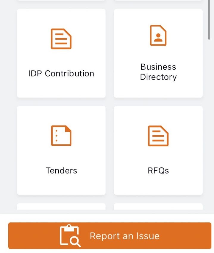
Did you know that you can now find out what is happening in and around George on the New My Smart City App?
Simply go to the Business Directory on the home page, and look up Things to do, Upcoming Events, Restaurants etc.

Download the NEW My Smart City – George APP NOW via the Apple App Store, the Google Play Store or via the My Smart City website www.mysmart.city or Scan the QR Code which can also be found on your current municipal statement

#CityofGeorge
#CityofOpportunities
#SmartCity

Public Notice: Unlock the power of Spatial Information with George Municipality’s GIS Public Viewer

Above is the The GIS Tool and Widgets are user-friendly and easy to access.

The George Municipality’s Geographic Information System (GIS) department is excited to introduce the GIS public viewer, a user-friendly online mapping tool designed to provide the residents of George and property professionals with easy access to spatial data that relate to the development of land, land transactions and investment planning.

The George Municipal mapping portal is your gateway to intelligent maps, focused applications and other geoinformation for the City of George. Answering the “where” question for any project, initiative or important decision is now easy for everyone!


GIS TOOLS/WIDGETS

The GIS viewer provides a wide variety of functionalities, including explore and query functions, cadastre database searches, draw and measurement tools, as well as GIS data import functions. The viewer also includes historical aerial imagery dated back as far as 1957, enabling a simple investigation into possible heritage assets and relevance on the site.  Comparisons between the imagery provide evidence relating to building activity, the timeline of development and the prevalence of biodiversity and related degradation, where applicable. The swipe widget can be used to compare historical imagery to the latest imagery by clicking on the layer and dragging the swipe bar across the screen.

The Elevation profile shows a land surface along a chosen path.  It is a graph with a distance on one axis and height (or elevation) on the other.  This profile enables a desktop investigation of the characteristics of the terrain, slopes, and overall shape of an area.  Elevation profiles can be used to assess factors like steepness, drainage issues, and suitability for construction, but also, among other uses, allude to potential risks, such as flooding, erosion or landslides.

LAYERS

The GIS viewer has various spatial layers, each containing valuable information stored in the attribute table. The property layer displays erf boundaries, erf size and erf number, while the zoning layer contains details on zoning parameters which includes the primary use and consent uses that may be applied for. The latest land use approvals are updated regularly for ease of reference have been granted.

The valuation layer displays information from the 2023 valuation roll, indicating the municipality’s assessed value of your property and is frequently updated. These layers collectively cover property information, property valuation and erf size, links to Surveyor-General (SG) diagrams, Integrating Zoning Scheme, administrative boundaries, information related to community services, Municipal Spatial Development Framework 2023 and related maps.

Additionally, the environment layer adds valuable spatial information that depicts data on rivers, slopes, natural protected areas, environmental buffer zones, OSCA applications, biodiversity areas, and more.  The environmental data enable property owners, property professionals or potential buyers to view the environmental constraints on the property and determine what level of protection or environmental custodianship is required in pursuit of their legislated ‘Duty of Care’.

USER GUIDE

To assist users, the GIS public viewer includes a step-by-step instruction for utilizing all available tools. GIS mapping portal gives access to Ready-to-print maps which are printable in PDF format.

For inquiries and further information, please contact the GIS department:

Email: gisadmin@george.gov.za

Office: 044 801 9117

Link to public Viewer: GIS Public Viewer

https://gis.george.gov.za/portal/home/

Mapping portal: GIS mapping portal


The layers you select are clearly illustrated on the map displayed, which you can print to generate your printable maps.

The home page of our GIS mapping portal where cadastral data, ready-to-print maps, 3D and historic imagery can be accessed among more.

OPENBARE DEELNAME: WYK 14 – SMME onderneming

OPENBARE DEELNAME: WYK 14
Kennisgewing word hiermee gegee om ‘n openbare deelname oor die bouplanne van die nuwe SMME-onderneming Hub-fasiliteit by te woon.
Datum: 12 Maart 2024
Tyd: 12:00 – 14:00
Plek: Pacaltsdorp Gemeenskapsaal
PUBLIC PARTICIPATION: WARD 14
Notices is hereby given to attend a Public Participation meeting regarding the construction plans of the new
SMME Business Hub facility.
Date: 12 March 2024
Time: 12:00 – 14:00
Location: Pacaltsdorp Community Hall

Unexpected Power Outage in Zone 8, Thembalethu

UPDATE: Unexpected Power Outage in Zone 8, Thembalethu
Issued by George Municipality, 29 February 2024 @12:00

An unexpected power outage has affected Zone 8 and the vicinity around All Brick since last night. The delay in repairs is attributed to addressing illegal connections in the area. The estimated time of repair is 3 hours.

The Municipality regrets any inconvenience caused and appreciates your patience as we work to restore the power supply.

UPDATE: Unexpected Power Outage in Parts of Parkdene, Ballots Bay and Thembalethu

UPDATE: Unexpected Power Outage in Parts of Parkdene, Ballots Bay and Thembalethu
Issued by George Municipality, 28 February 2024 @20:15

The power supply to potions of Parkdene, Ballots Bay and Zones 1, 2, 3 and 4 has been restored.

However, Zone 8 and the area adjacent to All Brick which is also experiencing an unexpected power outage will remain off for the rest of the night due to illegal connections that can only be removed tomorrow as a safety precautionary measure.

***

UNEXPECTED POWER OUTAGE IN PARTS OF PARKDENE, BALLOTS BAY AND THEMBALETHU
Issued by George Municipality, 28 February 2024 @19:55

An unexpected power outage occurred affecting parts of Parkdene Ballots Bay, and Zones 1,2,3 and 4 in Thembalethu. Electricians have been dispatched to investigate. The estimated time of repair is not available yet.